Skip to content
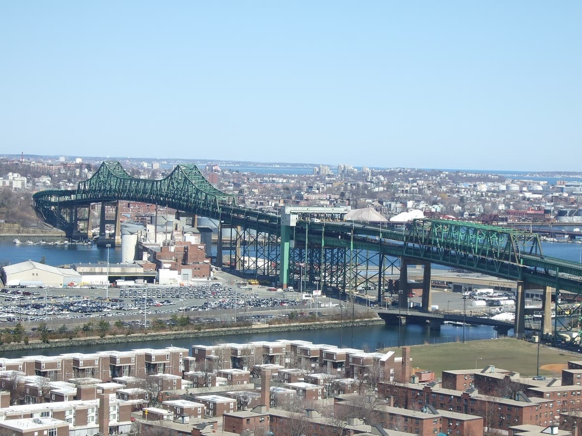
A long steel truss bridge crossing a river with a city skyline behind
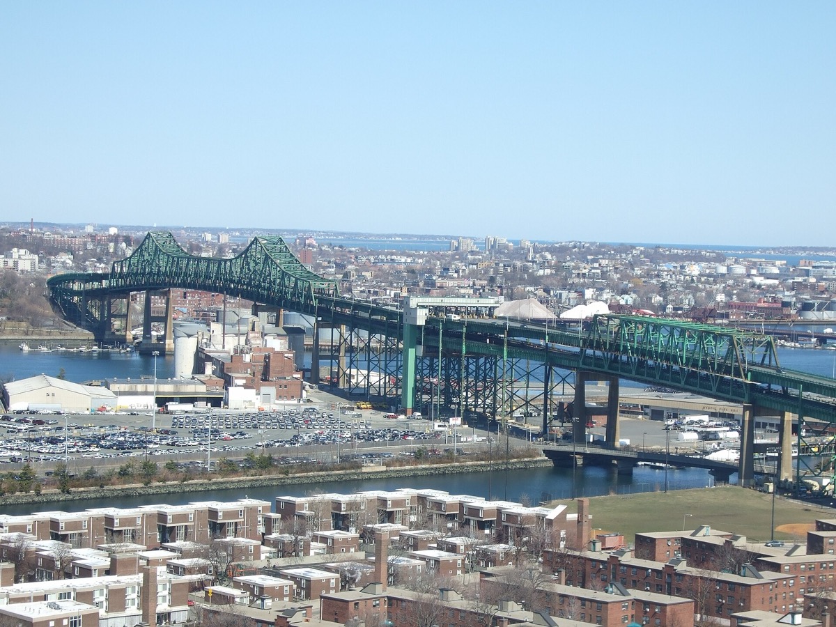
The Tobin Memorial Bridge seen from the Bunker Hill Monument, Charlestown, March 2008. Derek Yu · CC BY-SA 2.0

The film opens on boys playing street hockey. Wikipedia says the story puts that game in Charlestown; the fan location lists put it on a street in East Boston. Above: the Tobin Bridge from the Bunker Hill Monument, 2008. This page follows the neighbourhoods around it and leaves the crime out.

Sources

The game

Flick the ball

Seven marks on a chalked road, one for each place. Flick the ball to the next mark, or tap a mark to put it there. Flick past the last one and see where the ball goes.

Sources

0 flicks · mark 1 of 7

  1. Condor St
  2. Falcon St
  3. Tobin Bridge
  4. Doyle’s
  5. Bear Dens
  6. Monument works
  7. K Street

The ball sits on mark 1, Condor Street. Flick it down the road.

Two brick commercial buildings on a city street corner
Buildings at 320 and 326 Meridian Street, East Boston. A nearby street view, not the filming spot. Unknown (Commons upload) · CC BY-SA 2.0

Mark 1 · East Boston and Charlestown

Condor Street, East Boston

Both fan location lists put the opening street hockey game of 1975 on Condor Street at Meridian Street in East Boston.

Wikipedia says the film sets that scene in Charlestown. The fan lists place the filming in East Boston.

Both fan lists say the storm drain the ball disappears into was added for the film.

An ordinary residential street in East Boston. Walk it from the pavement and keep to the public footway.

Sources

The drain

Both fan lists say the storm drain the ball disappears into was added for the film.

Wikipedia says the film sets that scene in Charlestown. The fan lists place the filming in East Boston.

Sources
National Park Service

Bunker Hill Monument

Charlestown, Boston

Free admission to climb 294 stairs, 25 people at a time, with a view over the Charlestown side of the Tobin Bridge. The photograph here was taken from the monument. The climb can close for weather.

Plan the climb
Viator · Ad / affiliate

Boston movie location tours

Boston

Live marketplace results for film and TV location tours in Boston. Check which routes pass the neighbourhoods here.

Live marketplace results · itineraries change

Compare tours

South of the river

One road, two scenes

The fan lists put a pub and a monument works on the same road, Washington Street, at numbers 3484 and 3841.

3484 Doyle’s3841 Monument works

Washington Street house numbers, 3400 to 3900. The gauge shows the numbers only, not distance.

Sources
A brick corner pub front with signs and a green awning on a city street
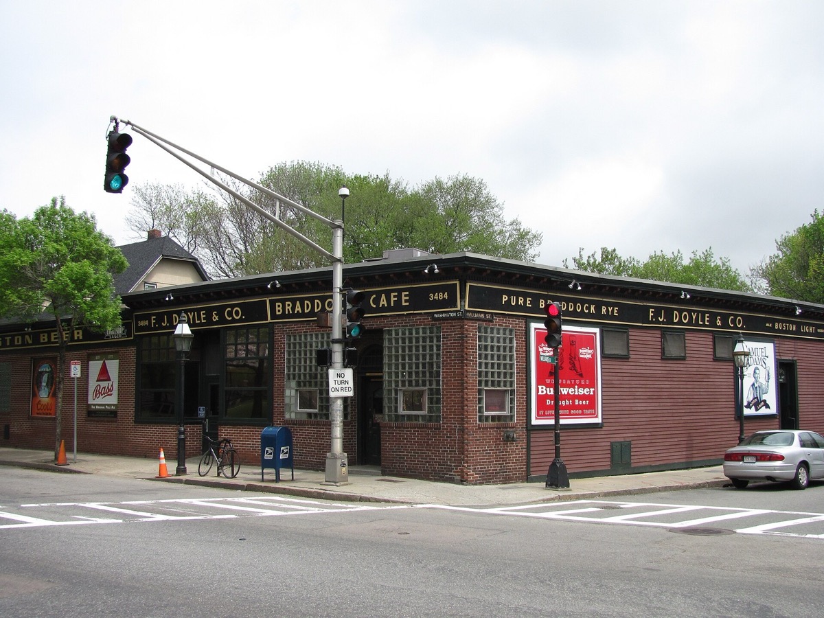
Doyle’s Cafe, Washington Street, Jamaica Plain, May 2011. John Phelan · CC BY 3.0

Doyle’s Cafe

Wikipedia says Doyle’s was founded in 1882 and appeared in Mystic River among other films.

It says the pub stood near the Samuel Adams brewery and was where Samuel Adams Boston Lager was first put on tap.

Wikipedia says Doyle’s closed at midnight on 26 October 2019, and that a project to revive it was approved in October 2021.

Sources
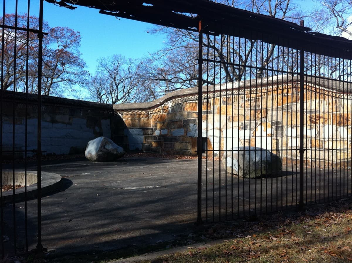
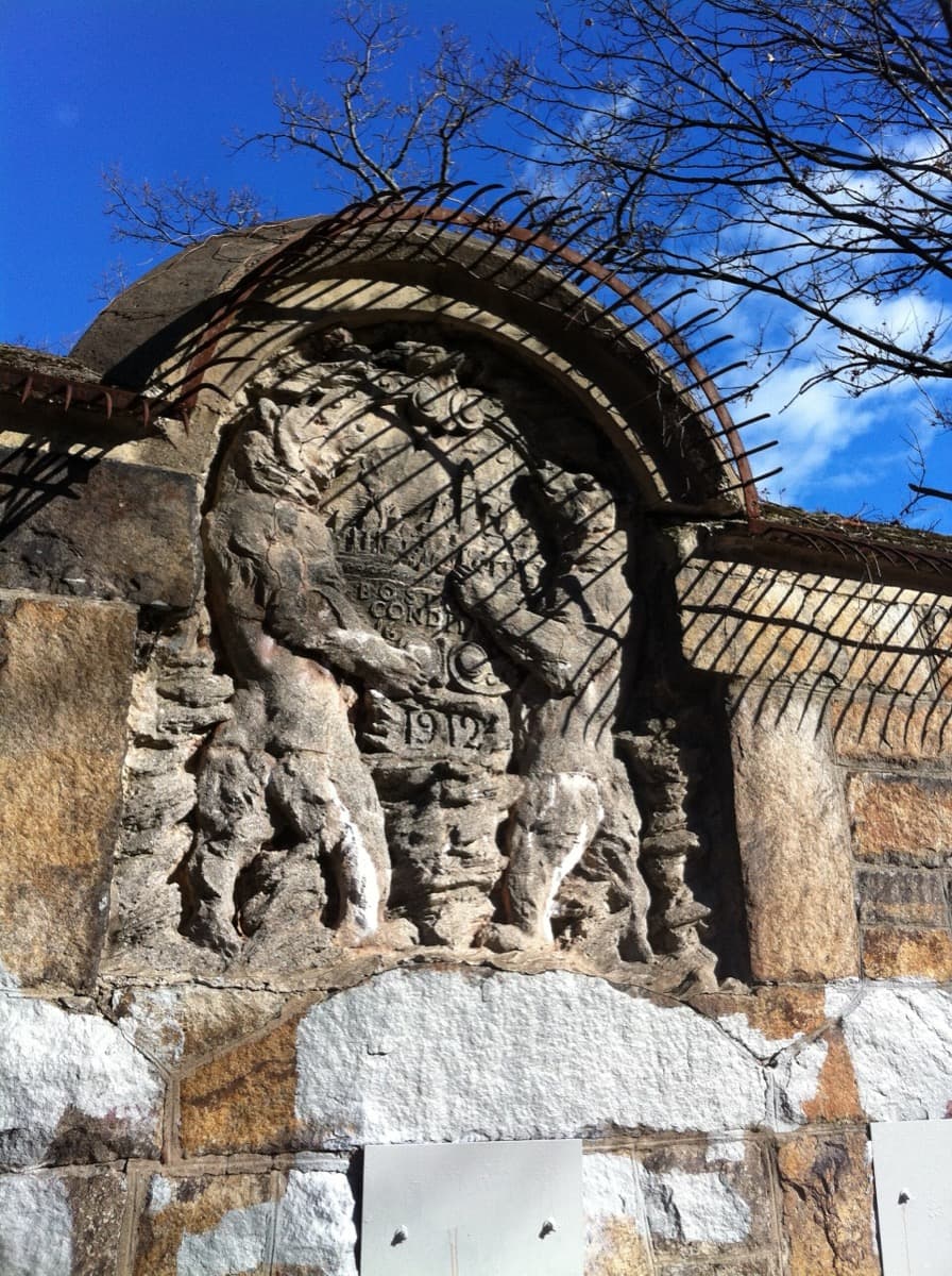
Weathered stone walls and arches of old animal dens among bare trees
The ruins of the 1912 Bear Dens in Long Crouch Woods, Franklin Park, November 2013. Ekmall · CC BY-SA 3.0
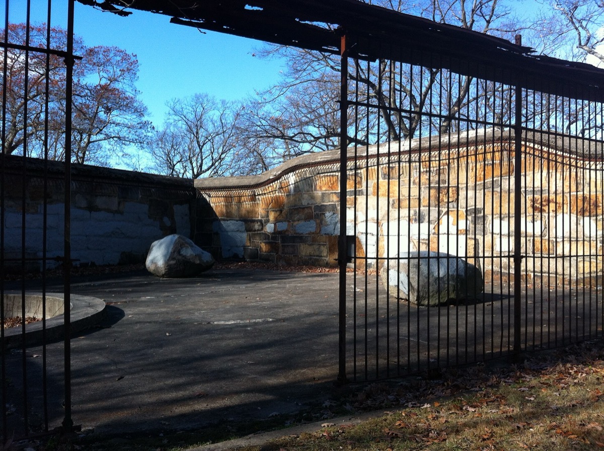
A rusted iron cage set into a stone wall
An iron cage in the Bear Dens ruins, Long Crouch Woods, Franklin Park, November 2013. Ekmall · CC BY-SA 3.0

The Bear Dens, Franklin Park

Wikipedia says the Bear Dens were built in 1912 as the focus of the original zoo, with a grand staircase, a courtyard and iron cages.

The exhibit closed in 1954, Wikipedia says, and the area was removed from zoo property in 1958.

Wikipedia calls Franklin Park the largest and last part of Frederick Law Olmsted’s Emerald Necklace, at 527 acres.

Sources
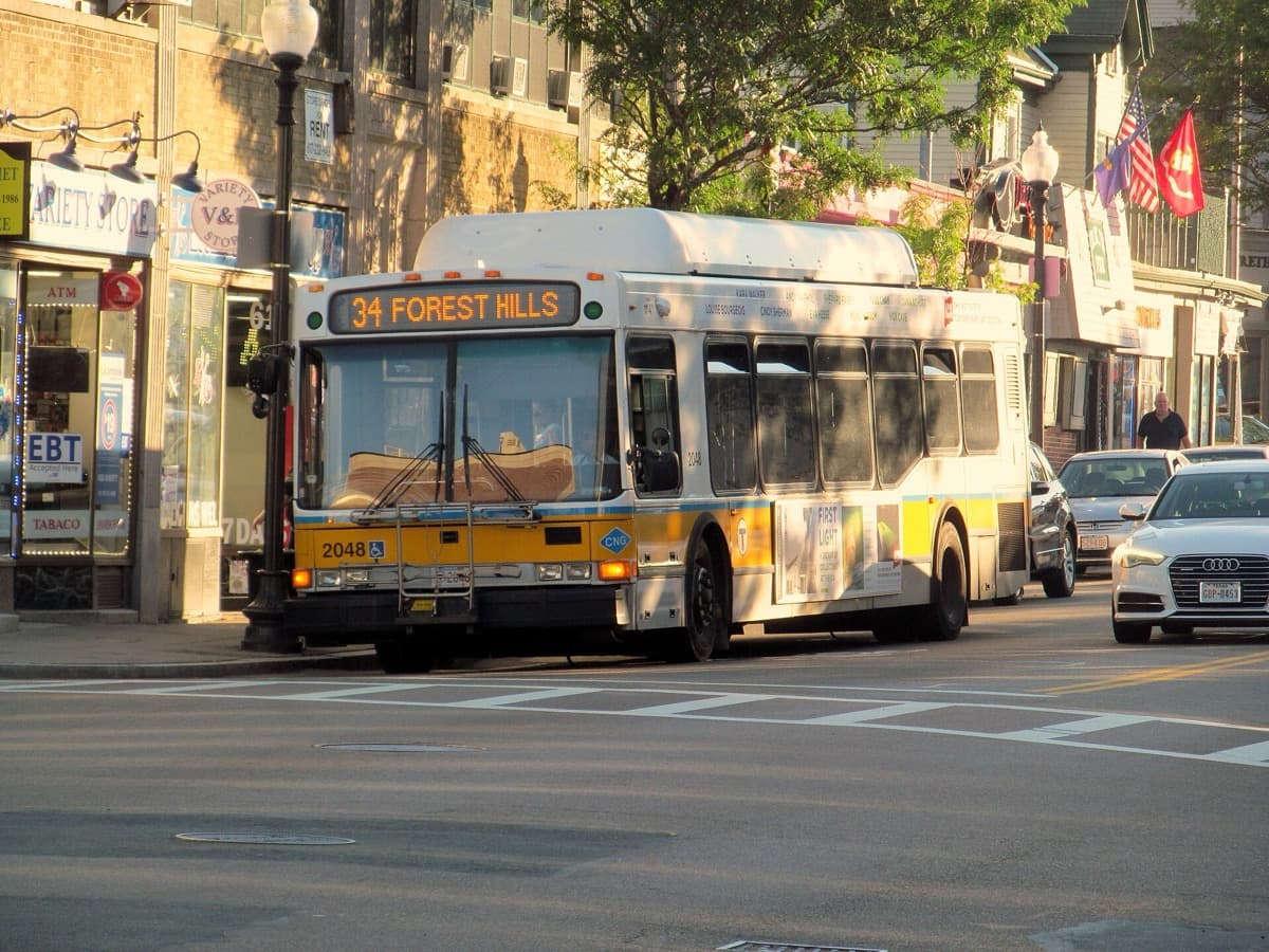
A bus stopped in a village-style square with shops
Washington Street at Roslindale Square, September 2016. A nearby street view, not the monument works. Pi.1415926535 · CC BY-SA 3.0

Wellsmere Monumental Works

Both fan lists give Wellsmere Monumental Works, 3841 Washington Street, Roslindale, as the monument maker in a quiet scene of choosing a memorial.

The two lists put Doyle’s Cafe at number 3484 and the monument works at number 3841, both on Washington Street.

A business address from the fan lists, not pinned here. Check what stands there before you travel.

Sources

The walk home

Go and look

Condor Street, the Tobin Bridge and Doyle’s Cafe are pinned. The Falcon Street houses are private, so only the street is named. The Bear Dens, the monument works and the K Street market are named without a pin.

Sources

Where it is now

3 places you can visit around Boston, plus four more named by their streets or grounds without a pin.

Pins mark public places; private homes are named but not pinned.

  • Area reference · Public access · Not an exact scene or camera position; not a visitor route. An ordinary residential street in East Boston. Walk it from the pavement and keep to the public footway.

  • Site reference · Public access · Not an exact scene or camera position; not a visitor route. A working road bridge on Route 1, not a walking route. Look at it from the Charlestown side; the photograph here was taken from the Bunker Hill Monument.

  1. Two brick commercial buildings on a city street corner
    Buildings at 320 and 326 Meridian Street, East Boston. A nearby street view, not the filming spot. Unknown (Commons upload) · CC BY-SA 2.0

    East Boston and Charlestown · Condor Street at Meridian Street, East Boston

    Condor Street, East Boston

    Both fan location lists put the opening street hockey game of 1975 on Condor Street at Meridian Street in East Boston.

    An ordinary residential street in East Boston. Walk it from the pavement and keep to the public footway.

    Sources
  2. A long steel truss bridge crossing a river with a city skyline behind
    The Tobin Memorial Bridge seen from the Bunker Hill Monument, Charlestown, March 2008. Derek Yu · CC BY-SA 2.0

    East Boston and Charlestown · Tobin Memorial Bridge, between Charlestown and Chelsea

    Tobin Memorial Bridge

    Wikipedia says the Tobin Bridge carries U.S. Route 1 over the Mystic River between Charlestown and Chelsea.

    A working road bridge on Route 1, not a walking route. Look at it from the Charlestown side; the photograph here was taken from the Bunker Hill Monument.

    Sources

Stay

A room on the harbour.

A downtown waterfront hotel, a short ride from East Boston and Charlestown.

Boston Harbor Hotel

Boston Harbor Hotel

Rowes Wharf, Boston

A waterfront hotel at 70 Rowes Wharf, downtown, with the harbour and city views its page lists. East Boston and Charlestown are a short ride away. Pictured: the Tobin Bridge, 2008.

Check rooms

Go there

Climb, walk, compare.

A free monument climb, a zoo beside the Bear Dens, and film location tours.

National Park Service

Bunker Hill Monument

Charlestown, Boston

Free admission to climb 294 stairs, 25 people at a time, with a view over the Charlestown side of the Tobin Bridge. The photograph here was taken from the monument. The climb can close for weather.

Plan the climb
Zoo New England

Franklin Park Zoo

Franklin Park, Boston

The zoo in Franklin Park, at 1 Franklin Park Road. Its page lists daytime hours of 9am to 4pm; check dates before you go. Pictured: an iron cage in the Bear Dens ruins, 2013.

Plan a visit
Viator · Ad / affiliate

Boston movie location tours

Boston

Live marketplace results for film and TV location tours in Boston. Check which routes pass the neighbourhoods here.

Live marketplace results · itineraries change

Compare tours

What’s on

No dates yet.

Nothing dated for the film is listed at these places now.

No current dated events are listed. Check providers for the latest programme.

Dates, prices, rooms and stock change: confirm with the provider before you travel or buy. A stay or tour is described as a filming location only where the card says so.

The archive

Every place and moment behind this page, with sources.

7 of 7 places · 8 of 8 stories

  • Condor Street, East Boston

    Condor Street at Meridian Street, East Boston

    • Street hockey, 1975

      Both fan lists place the opening game of street hockey on Condor Street at Meridian Street, East Boston.

    • The added drain

      Both fan lists say the storm drain the ball rolls into was added for the film.

  • Falcon Street, East Boston

    Falcon Street, East Boston (a block south of Condor Street)

    • Two homes on one street

      Both fan lists put two of the film’s family homes on Falcon Street, a block south of Condor Street.

  • Tobin Memorial Bridge

    Tobin Memorial Bridge, between Charlestown and Chelsea

    • The bridge behind

      Movie-Locations.com says the Tobin Bridge shows behind the hockey game and again in a later scene.

  • Doyle’s Cafe

    3484 Washington Street, Jamaica Plain

    • McGill’s

      Both fan lists give Doyle’s Cafe as the bar the film calls McGill’s.

  • The Bear Dens, Franklin Park

    Long Crouch Woods, near the Seaver Street entrance to Franklin Park

    • The old dens

      Both fan lists place a woodland scene at the old Bear Dens in Long Crouch Woods.

  • Wellsmere Monumental Works

    3841 Washington Street, Roslindale

    • The monument works

      Both fan lists give Wellsmere Monumental Works as the monument maker in a quiet scene.

  • Miller’s Market, South Boston

    336 K Street, South Boston

    • Cottage Market

      Both fan lists give Miller’s Market on K Street as the film’s Cottage Market.

Keep exploring

Where next?

Every place in Mystic River leads somewhere else.

On the mapExplore the atlasOpen the map
Your atlas

Keep Mystic River with the places you mean to see.

How saving works
Privacy