
Skip to content
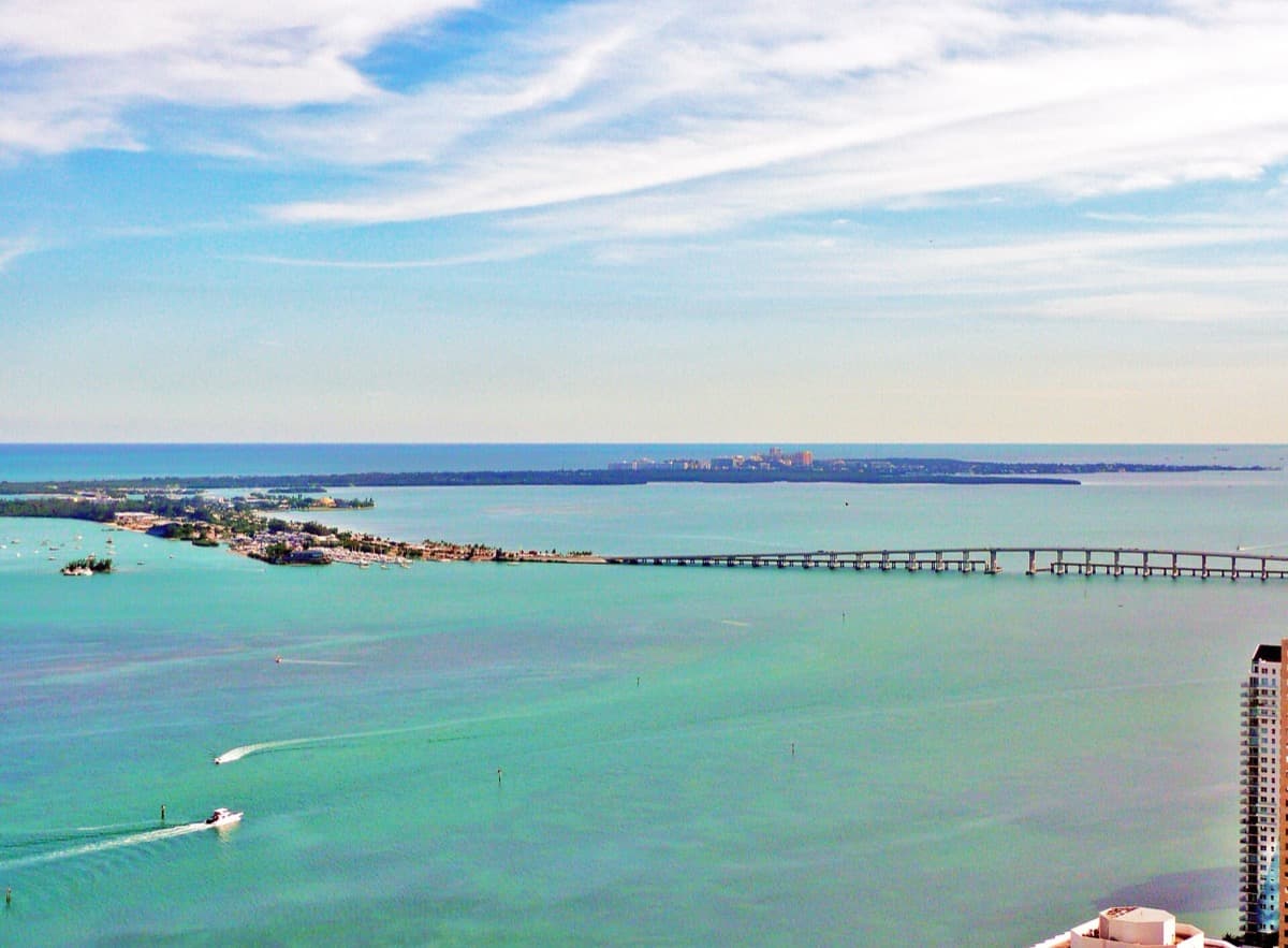
A long causeway road running over open water towards Miami
The Rickenbacker Causeway, February 2010. Averette · CC BY 3.0

Universal · 2003 · directed by John Singleton · Miami and the Keys

2 Fast 2 Furious

A fan location list gives the film a drive through Miami: a causeway over the bay, a drawbridge raised in a race, a Cuban restaurant, a state park and a bridge in the Keys. All are ordinary public places, and the list says where.

Sources

The drive

Cross the causeway

Six stops, north to south. Pick one and the marker car goes there.

Stop 1 of 6: Old Fire Station No. 2

0 km from the last stop, 0 km along the route, in straight lines.

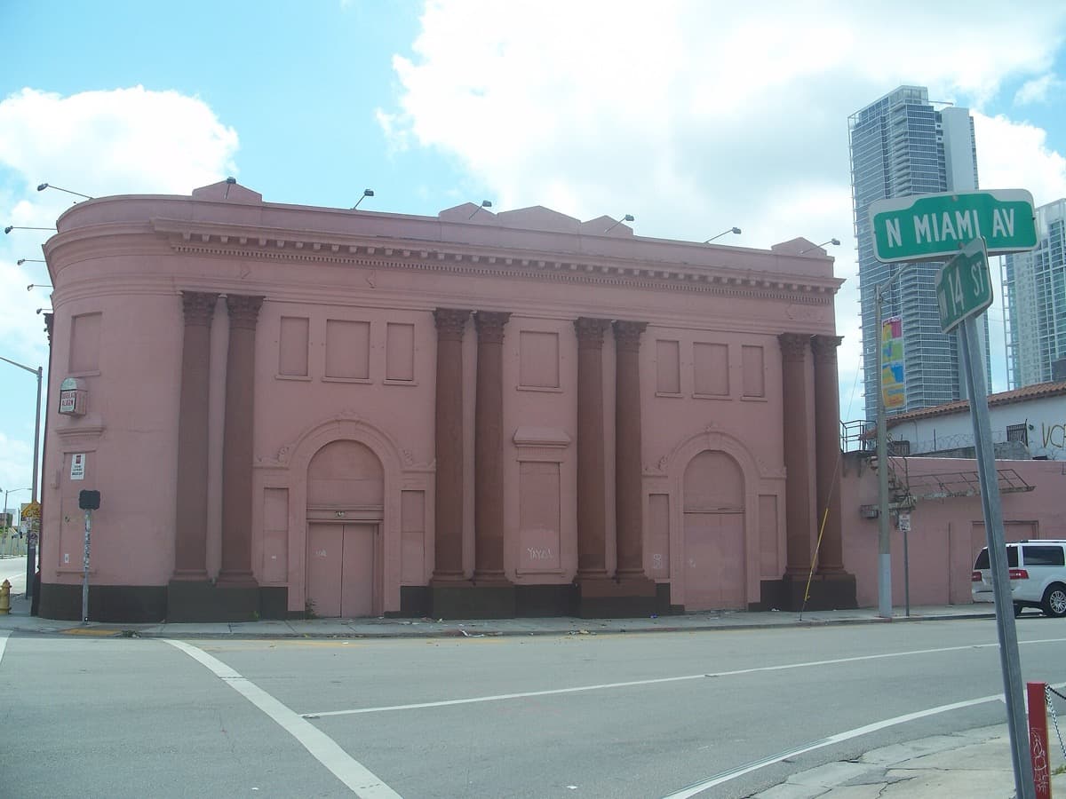
A brick fire station with arched bays on a Miami avenue
The old fire station at 1400 North Miami Avenue, 2011. The caption names the building beside the address the location list gives. Ebyabe · CC BY-SA 3.0

Miami

Old Fire Station No. 2

The fan location list gives the race starting point as 1401 North Miami Avenue, in front of the restaurant in the Old Fire Station No. 2.

OpenStreetMap lists the building at that address as Firehouse 2.

Sources

1 of 6 stops seen

The span

The bridge that moved

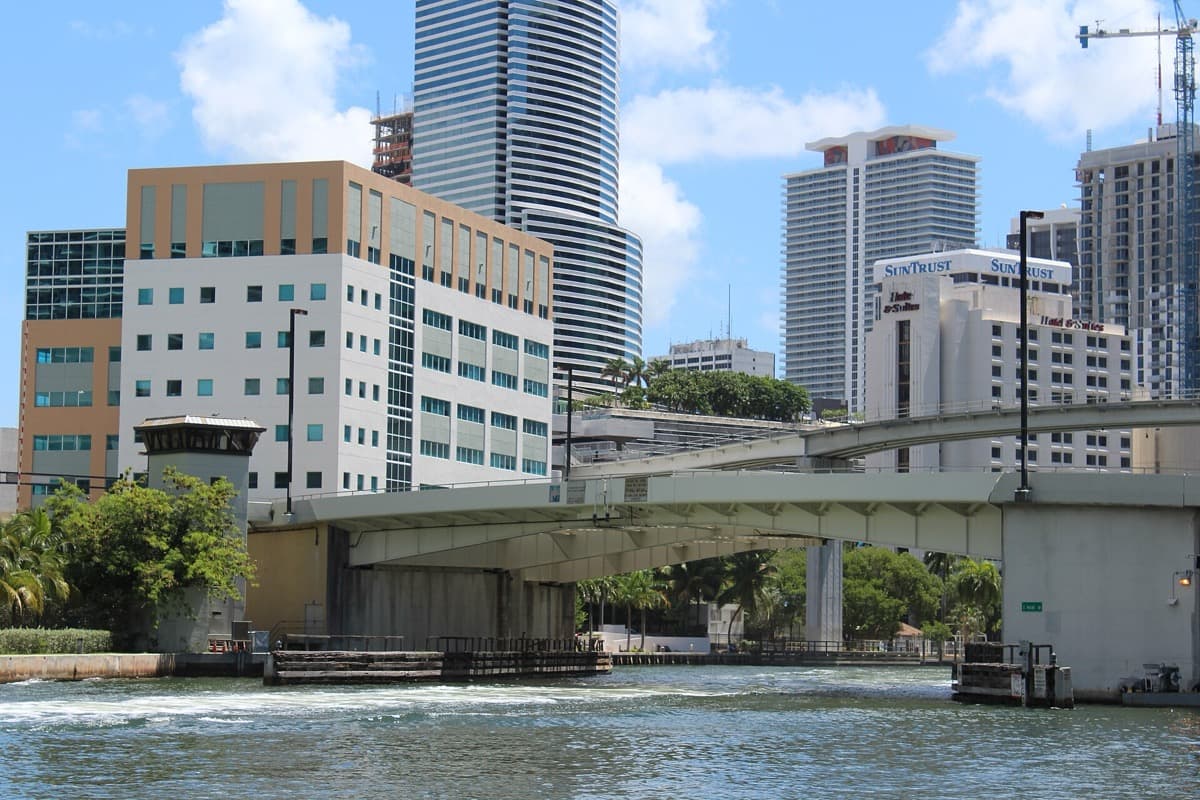
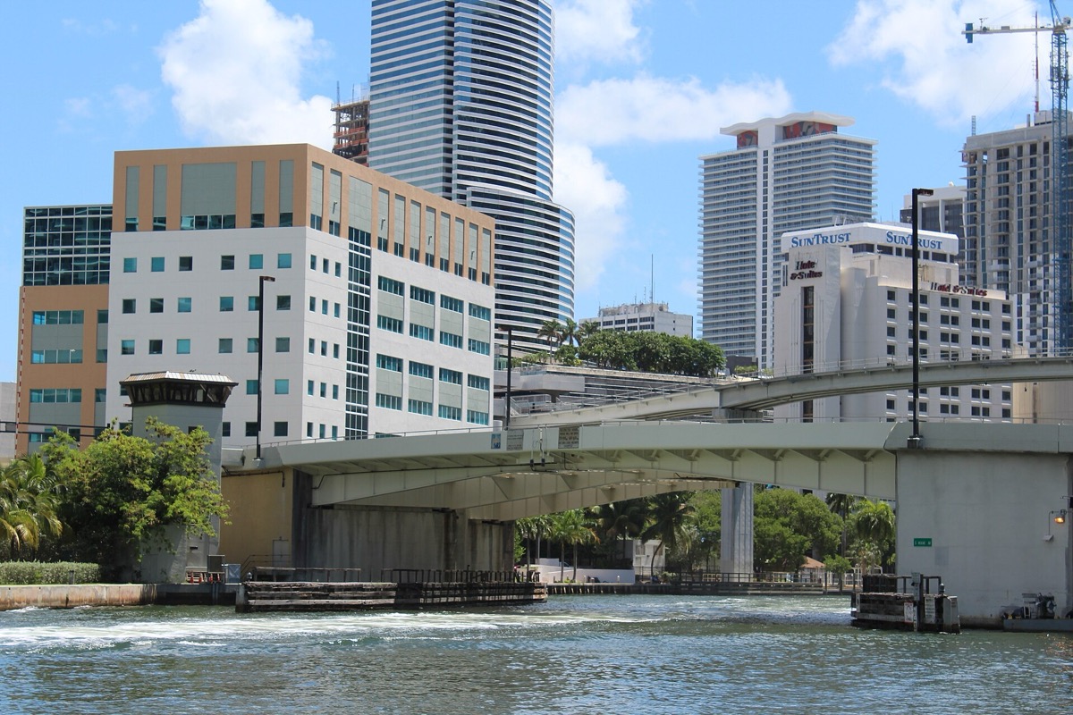
A steel drawbridge crossing the Miami River beside tall buildings
The Miami Avenue Bridge over the Miami River, June 2015. Phillip Pessar · CC BY 2.0

The span is down.

The list adds that the film moves the bridge digitally closer to the start and finish line.

Sources

Arrival

Go and find the places

All six are public. Bill Baggs and Seven Mile Bridge are pinned to the park and the bridge, not to the exact spot filmed. The Fast Five (2011) World covers a later film in the same series: see Fast Five.

Sources

Where it is now

6 places you can visit in Miami, on Key Biscayne and in the Florida Keys.

Pins mark public places; private homes are named but not pinned.

  • Exact filming spot not recorded. A brick fire station on North Miami Avenue, now with a restaurant in it. Seen from the pavement; check opening times before going in.

  • Exact filming spot not recorded. A working road bridge over the Miami River, open to walkers. When the span is raised for a boat, traffic waits.

  • Exact filming spot not recorded. A Cuban restaurant on SW 8th Street, open to walk in. Check hours before going.

  • Exact filming spot not recorded. A public toll road with a cycle lane, from Brickell out over the bay. Drive or cycle across; park at the beaches on Virginia Key.

  1. A brick fire station with arched bays on a Miami avenue
    The old fire station at 1400 North Miami Avenue, 2011. The caption names the building beside the address the location list gives. Ebyabe · CC BY-SA 3.0

    Miami · 1401 North Miami Avenue, Miami

    Old Fire Station No. 2

    The fan location list gives the race starting point as 1401 North Miami Avenue, in front of the restaurant in the Old Fire Station No. 2.

    A brick fire station on North Miami Avenue, now with a restaurant in it. Seen from the pavement; check opening times before going in.

    Sources
    Explore this place →
  2. A steel drawbridge crossing the Miami River beside tall buildings
    The Miami Avenue Bridge over the Miami River, June 2015. Phillip Pessar · CC BY 2.0

    Miami · South Miami Avenue over the Miami River, Brickell

    South Miami Avenue Bridge

    The fan location list says the drawbridge raised during the race is the South Miami Avenue Bridge, crossing the Miami River between 3rd and 6th Streets.

    A working road bridge over the Miami River, open to walkers. When the span is raised for a boat, traffic waits.

    Sources
    Explore this place →
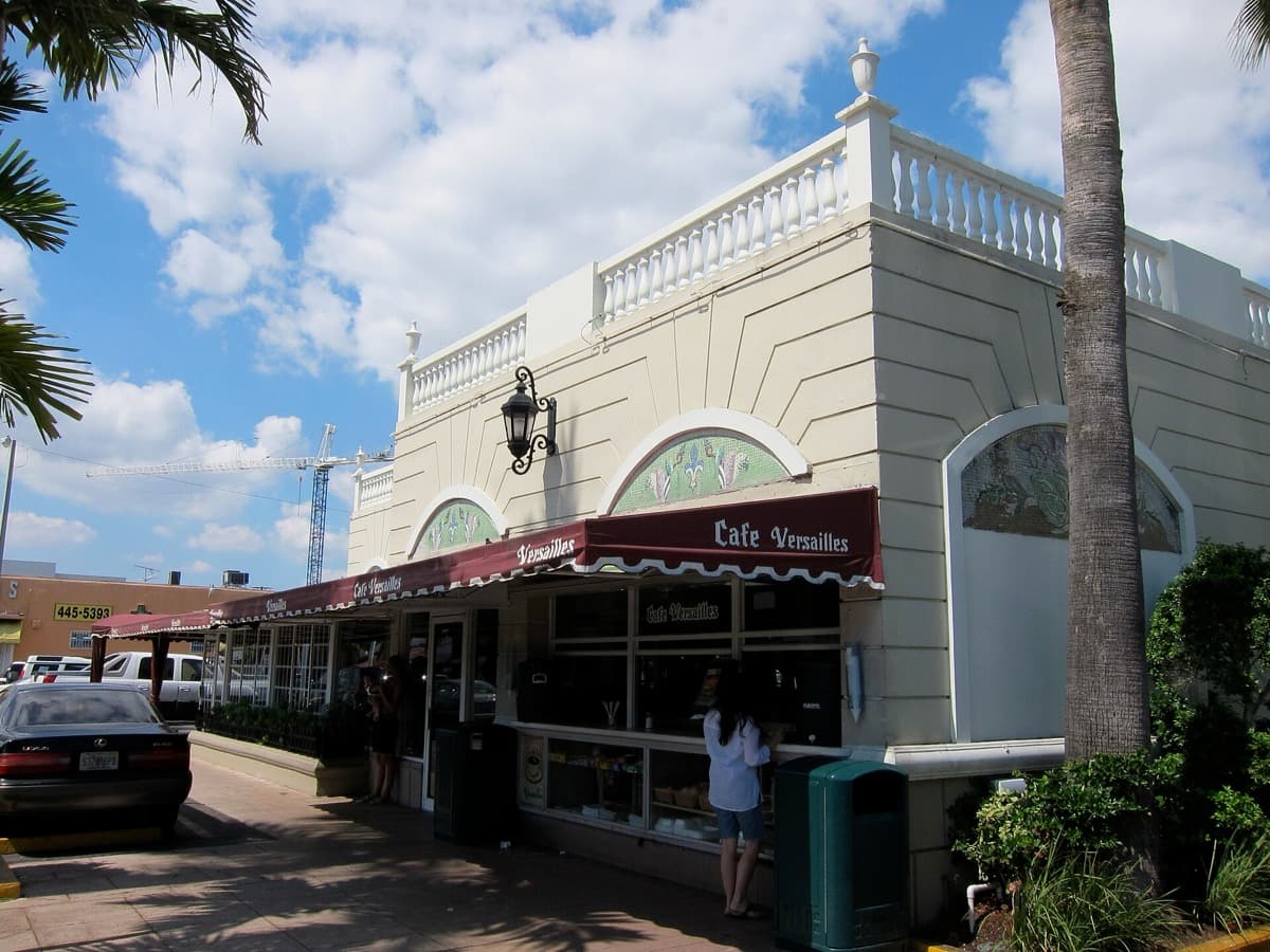
  3. A Cuban restaurant front with a lit sign on a Miami street
    Versailles Restaurant on SW 8th Street, Miami, October 2010. Eugene Kim · CC BY 2.0

    Miami · 3555 SW 8th Street, East Coral Gables

    Versailles Restaurant

    The fan location list places the meet-up with Verone’s men for the big job at Versailles Restaurant, 3555 SW 8th Street, in East Coral Gables.

    A Cuban restaurant on SW 8th Street, open to walk in. Check hours before going.

    Sources
    Explore this place →
  4. A long causeway road running over open water towards Miami
    The Rickenbacker Causeway, February 2010. Averette · CC BY 3.0

    Miami · Rickenbacker Causeway, between Brickell and Virginia Key

    Rickenbacker Causeway

    On his way south, toward Downtown Miami, O’Conner crosses the Rickenbacker Causeway, the fan location list says.

    A public toll road with a cycle lane, from Brickell out over the bay. Drive or cycle across; park at the beaches on Virginia Key.

    Sources
    Explore this place →

Stay

A room in Miami.

The city’s official visitor bureau lists hotels by type and by neighbourhood.

Greater Miami Convention & Visitors Bureau

Hotels in Miami and Miami Beach

Miami and Miami Beach

The city’s official visitor bureau sorts hotels by type and by neighbourhood, from Brickell, a few minutes from the South Miami Avenue Bridge, to Coral Gables. Pictured: the Miami Avenue Bridge, 2015.

Browse hotels

Dates, prices, rooms and stock change: confirm with the provider before you travel or buy. A stay or tour is described as a filming location only where the card says so.

The archive

Every place and moment behind this page, with sources.

6 of 6 places · 6 of 6 stories

3 more places from this productionAlready on the map, each with its source. Not part of the story above.

Map tiles © OpenStreetMap contributors

Keep exploring

Where next?

Every place in 2 Fast 2 Furious leads somewhere else.

On the mapExplore the atlasOpen the map
Your atlas

Keep 2 Fast 2 Furious with the places you mean to see.

How saving works

Once a week

New places near you, once a week.

One story, one place and one thing to do near you. Free, and you can stop any time.

TermsPrivacyCookiesDelete accountAffiliate disclosureLegal