The story says · California
Kennedy Meadows
The hikers’ base in California, about 135 miles in, where Cheryl lightens her pack.
Fox Searchlight · 2014 · shot in autumn 2013
The story walks 1,100 miles from the Mojave to the Columbia River. All but seven scenes were shot in Oregon, and only two on the trail itself.
Walk the stops
Slide the hiker down ten stops. Each one shows what the story says and the place in Oregon that played it.
1 of 10 stops walked · 1 of 4 California stops played by Oregon
The story says · California
The hikers’ base in California, about 135 miles in, where Cheryl lightens her pack.
The film shot it at · Central and southern Oregon
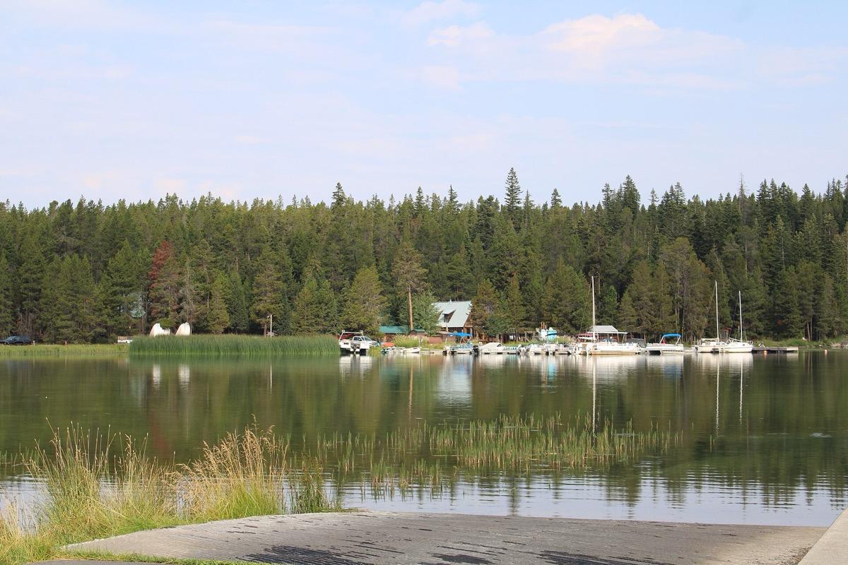
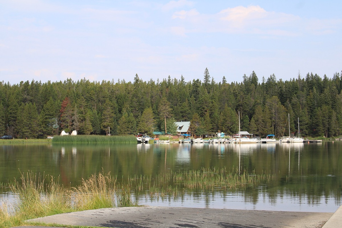
Paulina Lake Lodge stands in for Kennedy Meadows in California, which sits some 135 miles into the real hike.
The lodge is a 14-cabin retreat. Its green metal roof and log walls are easy to spot in the film.
An owner said the crew stayed about ten days. It snowed in what was meant to be summer, then melted fast.
A lakeside cabin resort inside the volcano. Its site says it is closed until mid-December 2026, then open daily from 17 December to 28 March 2027; snow transfers run from a SnoPark.
Stop 1: Kennedy Meadows. Shot at Paulina Lake Lodge.

Monster
Witherspoon said the shoot never stopped for lunch in remote spots, and that a 45-pound pack was swapped for a 65-pound one so it looked heavy enough.
The story’s pack is so heavy Cheryl calls it Monster, and at Kennedy Meadows other hikers help her lighten it. Go! Magazine lists Paulina Lake Lodge among the film’s Oregon filming locations.
Many props and costumes came from Oregon businesses. Danner Boots recreated the boot from the memoir’s cover, and vintage clothing for the extras came from the outdoor shop Next Adventure.
The location manager, Nancy Haecker, had also worked on Sean Penn’s Into the Wild. For this one she said the crew needed places that were accessible, cinematic and could serve several purposes, so the crew did not have to pack up each day.
Wild: From Lost to Found on the Pacific Crest Trail is Cheryl Strayed’s 2012 memoir; Jean-Marc Vallée directed the film.
Journey’s end
Most of these are public land, parks or streets. Paulina Lake Lodge is shut for the autumn. Ashland and the Davis Street cafe are not pinned because no shopfront was checked; the Badlands pin is the middle of the wilderness and the Overlook restaurant on North Skidmore Street has closed and is pinned where it stood.
9 places you can visit across Oregon, from a Mount Hood ridge to a county park.
Pins mark public places; private homes are named but not pinned.
Exact filming spot not recorded. A lakeside cabin resort inside the volcano. Its site says it is closed until mid-December 2026, then open daily from 17 December to 28 March 2027; snow transfers run from a SnoPark.
Approximate area. Public land with marked trailheads east of Bend. The pin is the centre of the wilderness, not a trailhead.
Exact filming spot not recorded. A small store in a farming community. Whether it still trades was not checked; the photograph shows an irrigated field on Alfalfa Market Road, a nearby view.
Exact filming spot not recorded. A state park with day-use trails above the Crooked River. Pay the day-use fee at the park.
Exact filming spot not recorded. A national park with a rim road, viewpoints and a visitor centre. Winter snow closes parts of the road.
Central and southern Oregon · Paulina Lake, Newberry National Volcanic Monument
Paulina Lake Lodge stands in for Kennedy Meadows in California, which sits some 135 miles into the real hike.
A lakeside cabin resort inside the volcano. Its site says it is closed until mid-December 2026, then open daily from 17 December to 28 March 2027; snow transfers run from a SnoPark.
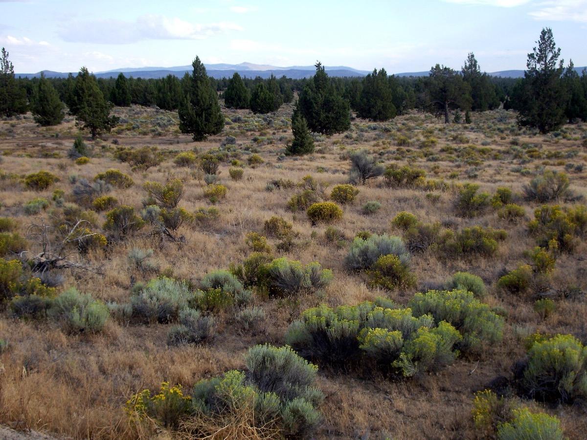
Central and southern Oregon · East of Bend, Deschutes County
The Badlands east of Bend became California’s Modoc Plateau and the Mojave Desert, with some strategically placed Joshua trees.
Public land with marked trailheads east of Bend. The pin is the centre of the wilderness, not a trailhead.
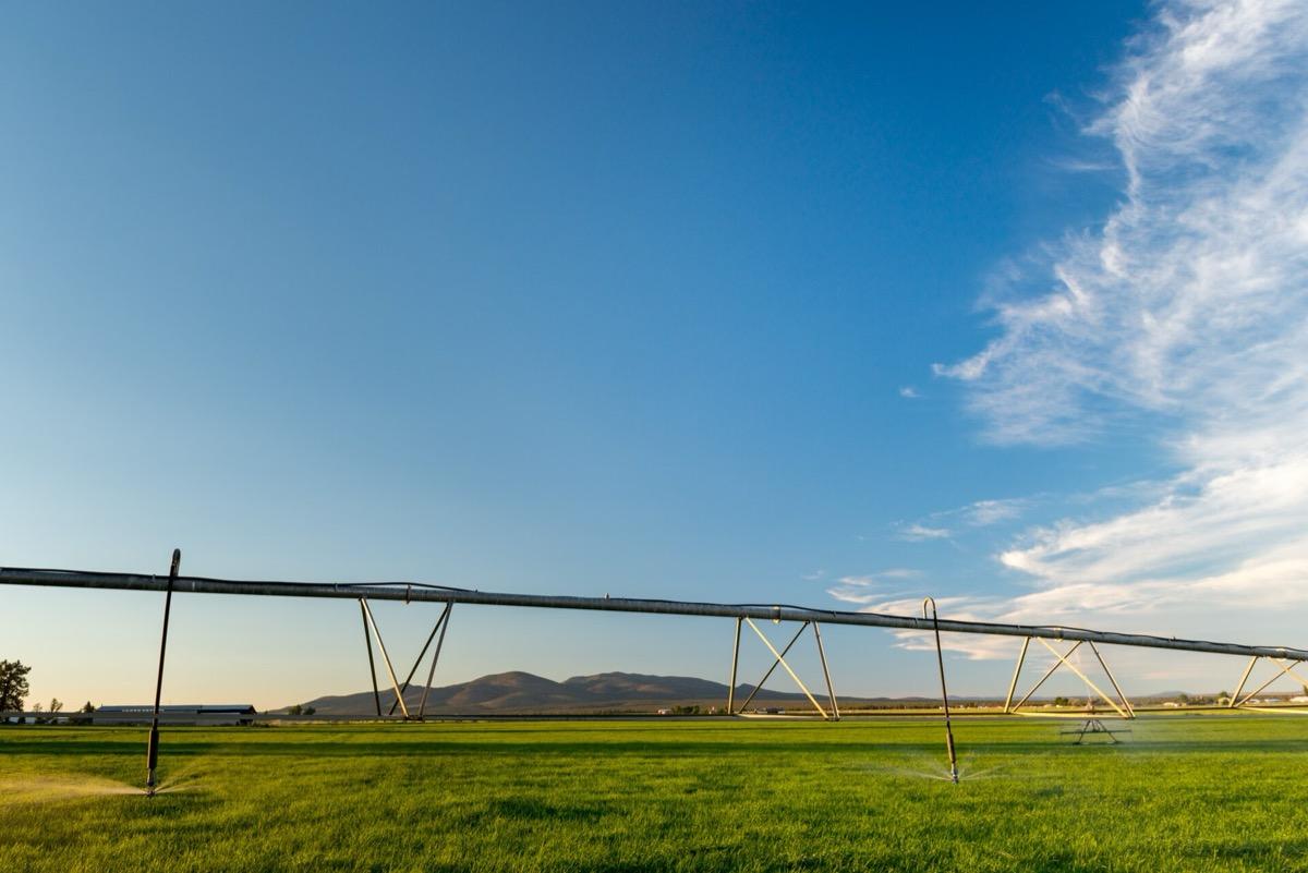
Central and southern Oregon · Alfalfa, 15 miles east of Bend
The convenience store where Cheryl buys fuel for her stove is not in the Mojave but in Alfalfa.
A small store in a farming community. Whether it still trades was not checked; the photograph shows an irrigated field on Alfalfa Market Road, a nearby view.
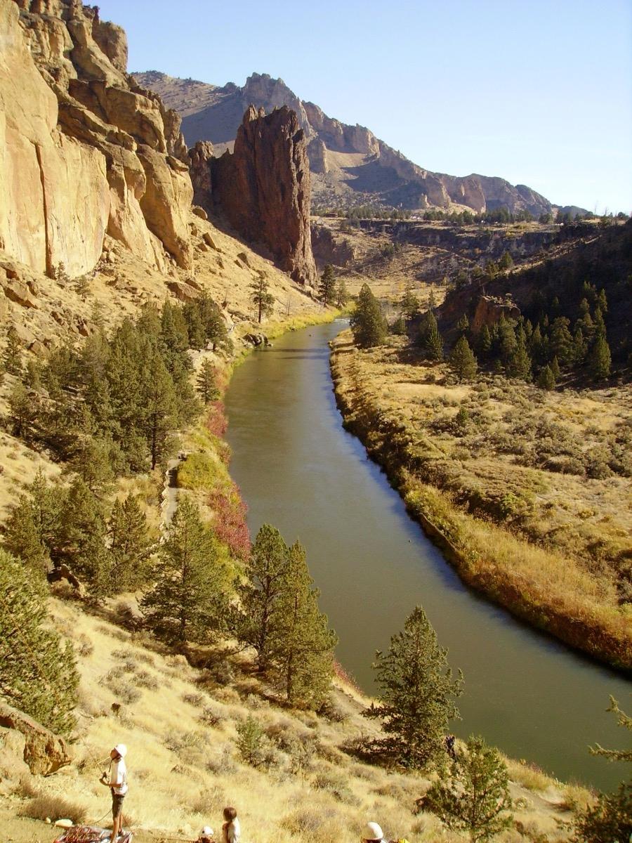
Central and southern Oregon · Smith Rock State Park, Terrebonne
Smith Rock was used for a rock-scrambling scene.
A state park with day-use trails above the Crooked River. Pay the day-use fee at the park.
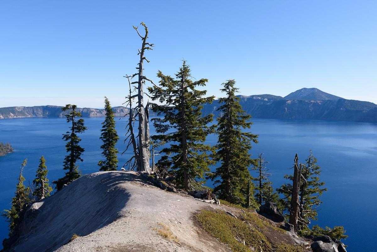
Central and southern Oregon · Crater Lake National Park, Klamath County
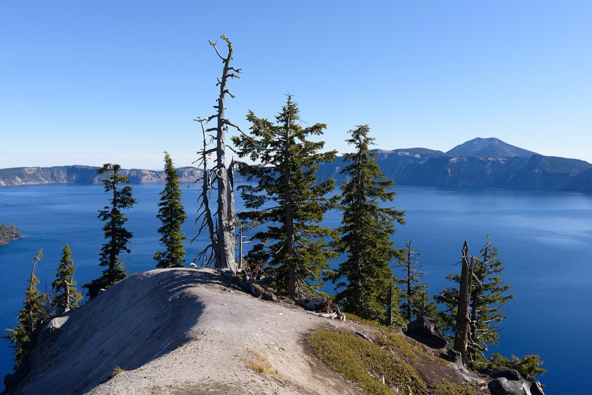
Crater Lake was one of Strayed’s real stops, and it makes a short appearance in the film: she camps by the lake and looks out over the water.
A national park with a rim road, viewpoints and a visitor centre. Winter snow closes parts of the road.
Newberry National Volcanic Monument, Central Oregon
The lakeside cabins that play Kennedy Meadows. The lodge says it is closed until mid-December 2026, with winter cabins open from 17 December. Pictured: the lodge and its docks, August 2025.
Check datesCrater Lake National Park, Oregon
The park’s official page, which lists trolley and boat tours. It carries a notice that the Cleetwood Cove Trail and Marina are closed for a three-year rehabilitation, so check what is running. Pictured: Crater Lake, October 2019.
Check the park pageStay
The lakeside lodge that plays Kennedy Meadows.
Newberry National Volcanic Monument, Central Oregon
The lakeside cabins that play Kennedy Meadows. The lodge says it is closed until mid-December 2026, with winter cabins open from 17 December. Pictured: the lodge and its docks, August 2025.
Check datesGo there
The national park’s own page for Crater Lake, with trolley and boat tours.
Crater Lake National Park, Oregon
The park’s official page, which lists trolley and boat tours. It carries a notice that the Cleetwood Cove Trail and Marina are closed for a three-year rehabilitation, so check what is running. Pictured: Crater Lake, October 2019.
Check the park pageDates, prices, rooms and stock change: confirm with the provider before you travel or buy. A stay or tour is described as a filming location only where the card says so.
Every place and moment behind this page, with sources.
11 of 11 places · 12 of 12 stories
Mirror Lake Trail, near Government Camp, Mount Hood
A ridge near Mount Hood plays a California stretch near Lassen; the boots go over the edge.
Mount Hood Skibowl, near Government Camp
Witherspoon rides the Upper Bowl chairlift to the ridge instead of hiking up.
Paulina Lake, Newberry National Volcanic Monument
A cabin lodge in a volcano plays the California hikers’ base where Cheryl lightens her pack.
East of Bend, Deschutes County
Oregon juniper country, with Joshua trees added, plays the Modoc Plateau and the Mojave.
Alfalfa, 15 miles east of Bend
A farming-town store plays the desert shop where Cheryl buys fuel.
Smith Rock State Park, Terrebonne
Smith Rock hosts a rock-scrambling scene.
Crater Lake National Park, Klamath County
A government shutdown closes Crater Lake before the crew has all its scenes.
Main Street, downtown Ashland
A single day of filming in Ashland takes in a boutique, the post office and a restaurant.
Northwest Davis Street, Portland
Portland stands in for California, Nevada and Minnesota as well as itself.
A Northwest Davis Street cafe plays the restaurant where Cheryl tells someone her news.
1332 North Skidmore Street, Overlook, north Portland
A North Skidmore Street restaurant with video gambling machines doubles for a casino in Reno.
Eagle Fern Park, Clackamas County
The climax is shot in a park southeast of Portland.
Every place here leads somewhere else.
Once a week
One story, one place and one thing to do near you. Free, and you can stop any time.